Click here to visit:
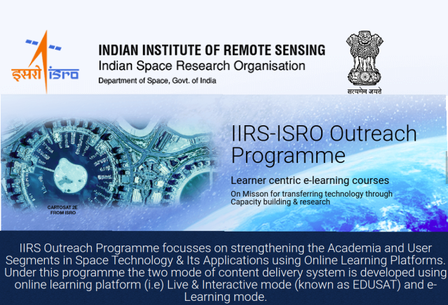
Bharat Institute of Engineering & Technology is the Remote Centre for Indian Institute of Remote Sensing- Indian Space Research Organization (IIRS-ISRO) – Outreach Program
Bharat Institute of Engineering and Technology is the remote centre for conducting the outreach programs by Indian Institute of Remote Sensing (IIRS) since July 2024. The Indian Institute of Remote Sensing (IIRS) is a premier institute for research, higher education and training in the field of Remote Sensing, Geoinformatics and GPS Technology for Natural Resources, Environmental and Disaster Management under the Indian Department of Space.
Objective of this outreach program is to provide an opportunity for individuals to learn Remote Sensing and Geoinformation Science for the benefit of their professional career. Courses in Remote Sensing and Geoinformation Science will allow graduates to build their knowledge and practical expertise in RS and GIS technologies with independent study and project experience at the certificate level. IIRS ISRO E-learning platform offers different courses such as Basics of Geocomputation and Geoweb services, RS & GIS Applications, Geographical Information systems, Understanding of Coastal Ocean processes using RS & Numerical Modelling, Global navigation satellite systems, RS & Digital image analysis, RS Applications in agricultural water management and many more.
IIRS -ISRO Nodal Center Coordinator :
Dr Papiya Dutta
Associate Professor
Bharat Institute of Engineering & Technology
Hyderabad